
All Images
News Release 17-104
How much water flows into agricultural irrigation? New study provides 18-year water use record
Findings will lead to better agriculture choices and water management decisions
This material is available primarily for archival purposes. Telephone numbers or other contact information may be out of date; please see current contact information at media contacts.
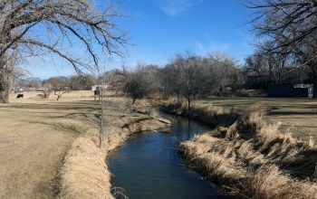
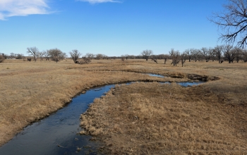
Farms are common along the North Fork of the Republican River near Wray, Colorado.
Credit: Wikimedia Commons/Jeffrey Beall
Download the high-resolution JPG version of the image. (18.2 MB)
Use your mouse to right-click (Mac users may need to Ctrl-click) the link above and choose the option that will save the file or target to your computer.
The Republican River Basin, where the study took place. Here, just south of Cambridge, Nebraska.
Credit: Wikimedia Commons/Ammodramus
Download the high-resolution JPG version of the image. (2.3 MB)
Use your mouse to right-click (Mac users may need to Ctrl-click) the link above and choose the option that will save the file or target to your computer.
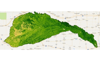
More than 9,000 Landsat images provide vegetation health metrics for the Republican River Basin.
Credit: David Hyndman
Download the high-resolution JPG version of the image. (190.7 KB)
Use your mouse to right-click (Mac users may need to Ctrl-click) the link above and choose the option that will save the file or target to your computer.
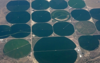
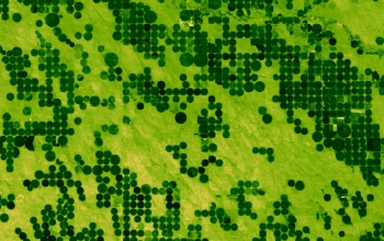
This aerial photo was taken east of Denver, Colorado, above a region dense with irrigation systems.
Credit: David Hyndman
Download the high-resolution IRRIGATION version of the image. (3.2 MB)
Use your mouse to right-click (Mac users may need to Ctrl-click) the link above and choose the option that will save the file or target to your computer.
An Enhanced Vegetation Index from Landsat imagery helps define irrigated fields in the study area.
Credit: David Hyndman
Download the high-resolution JPG version of the image. (4.5 MB)
Use your mouse to right-click (Mac users may need to Ctrl-click) the link above and choose the option that will save the file or target to your computer.
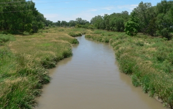
The Republican River's South Fork near Hale, Colorado, with the region's seemingly endless fields.
Credit: Wikimedia Commons/Jeffrey Beall
Download the high-resolution JPG version of the image. (14.2 MB)
Use your mouse to right-click (Mac users may need to Ctrl-click) the link above and choose the option that will save the file or target to your computer.