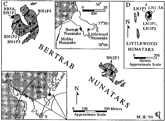
Figure 2. Maps of the Bertrab and Littlewood nunataks showing the location, geology, and sampling sites. The location of inset B is shown by the black box in inset A . Inset B shows the location of the Bertrab and Littlewood Nunataks. Medium shading in main figure ( C ) and inset D denotes granophyre at the Bertrab Nunataks and rhyolite at the Littlewood Nunataks. Within the Bertrab Nunataks, solid, black lines are mafic dikes and northeast-trending, shaded dikes are rhyolite (after Gose et al. 1997).