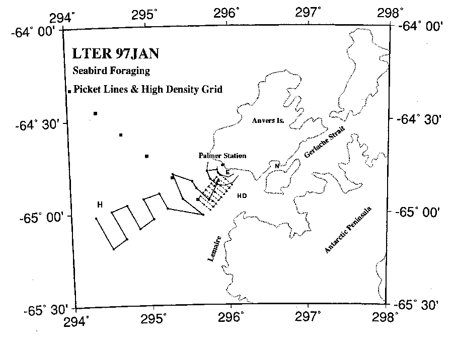
Figure from Palmer LTER: Annual January cruise for 1997 (PD97-1)
Return to the article from which this figure is taken.

|
| Figure 2. Sampling area near Palmer Station on Anvers Island with the Neumeyer (N) and Gerlache Strait to the East. Locations are shown for inshore station (E) of the Palmer nearshore stations and the Hugo AWS (H). The 3.7-km and 10-km picket lines, the multi-picket line (solid line), and the high-density grid (HD; dashed line) are shown. The LTER regional grid 600 line stations 040, 060, 080, 100, 120 are marked (filled squares). |