Figure from AMLR program: Variability of pH in the upper water column
Return to the article from which this figure is taken.
|
|
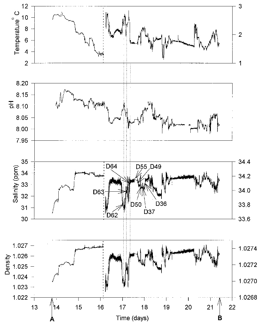
| Figure 1. Values of temperature, pH, salinity, and density of seawater pumped from 5 meters depth during a transect from the Straits of Magellan (point A; 52.88°S 70.47°W) into Bransfield Strait and then north to Seal Island, just to the northwest of Elephant Island (point B; 60.99LS 55.34°W). The dates shown on the abscissa are from March of 1997. The vertical dashed lines early on 16 March show where the scales of the ordinates have been changed (except for pH); all values to the right of the dotted lines refer to the right-hand scales. The times of occupying eight of our stations are shown on the salinity plot. The Polar Front, where the temperature was approximately 4.5°C, was crossed between days 15 and 16. (ppm denotes parts per million.) |