Figure from Neogene paleosols of the Sirius Group, Dominion Range, Antarctica
Return to the article from which this figure is taken.
|
|
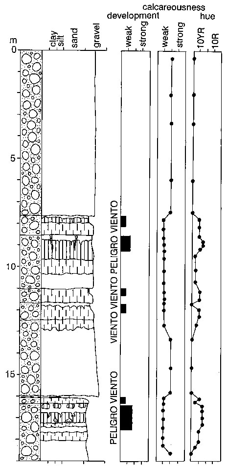
| Figure 1. A measured section of paleosols down from the crest of the prominent scarp in central Meyer Desert, Dominion Range, Antarctica. Names are pedotypes, or field names, for recognizably different kinds of paleosols. Black boxes represent position of paleosols, their width corresponding to development. Scales of calcareousness are from relative reaction with dilute hydrochloric acid and hue is from a Munsell color chart. For key to lithological symbols, see figure 2. |