Figure from Palmer LTER: Annual January cruise for 1997 (PD97-1)
Return to the article from which this figure is taken.
|
|
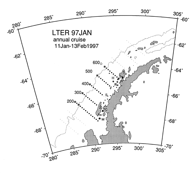
| Figure 1. The cardinal stations of the Palmer LTER regional grid (dots) off the Antarctic Peninsula are overlaid to indicate standard station sampling (large dots) and conductivity-temperature-depth (CTD) sampling (circles) during PD 97-1. Labeled are Anvers Island (1), Adelaide Island (2), Torgersen Island (T), Palmer Station (O), Rothera Station (R), Vernadsky Station (V), Hugo AWS (H; 64°957'S 65°941'W), sediment trap (triangle), northern stations (N; inverted triangle), southern stations (S; inverted triangle), Marguerite Bay (M; diamond), Tickle Channel (TC; diamond), and hydrographic parameters only stations (star). The 1,000-m bathymetry line (dotted) is shown. |