Figure from Studies of the west antarctic ice sheet, 1996-1997
Return to the article from which this figure is taken.
|
|
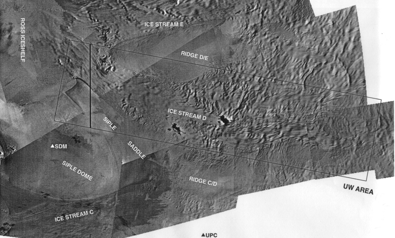
| Figure 1. Location map of the University of Wisconsin survey area over ice stream D. The satellite-image base map is from P.L. Vornberger and R.A. Bindschadler (personal communication). North is toward the upper left corner. Triangles denote surface camps "Siple Dome" (SDM) and "Upstream C" (UPC). Flow in the ice streams is from right to left. The box shows only the margins of the UW block; the grid of individual flight lines covers the block at 5-kilometer intervals in both directions. The heavy line denotes the location of the section in figure 2. |