
All Images
News Release 18-034
Hurricanes: Stronger, slower, wetter in the future?
New analysis compares 22 named storms with possible hurricanes of the future
This material is available primarily for archival purposes. Telephone numbers or other contact information may be out of date; please see current contact information at media contacts.
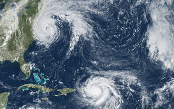
Will future hurricanes resemble 2017's Jose (top) and Maria? Scientists have new answers.
Credit: NASA
Download the high-resolution JPG version of the image. (9.9 MB)
Use your mouse to right-click (Mac users may need to Ctrl-click) the link above and choose the option that will save the file or target to your computer.
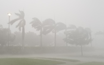
A gale blows across the Florida Gulf Coast during Hurricane Irma in 2017.
Credit: Center for Severe Weather Research
Download the high-resolution JPG version of the image. (1.8 MB)
Use your mouse to right-click (Mac users may need to Ctrl-click) the link above and choose the option that will save the file or target to your computer.

Hurricane Irma resulted in extensive damage in the Florida Keys, such as boats blown onto land.
Credit: USFWS
Download the high-resolution JPG version of the image. (224.3 KB)
Use your mouse to right-click (Mac users may need to Ctrl-click) the link above and choose the option that will save the file or target to your computer.
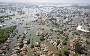
Hurricane Harvey left widespread flooding in its wake in 2017.
Credit: South Carolina National Guard
Download the high-resolution JPG version of the image. (279.2 KB)
Use your mouse to right-click (Mac users may need to Ctrl-click) the link above and choose the option that will save the file or target to your computer.
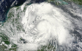
Hurricane Ernesto tore a path through the Caribbean in 2012.
Credit: NASA
Download the high-resolution JPG version of the image. (133.4 KB)
Use your mouse to right-click (Mac users may need to Ctrl-click) the link above and choose the option that will save the file or target to your computer.
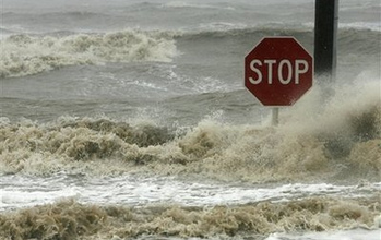
Hurricane Gustav flooded roads in Bay St. Louis, Mississippi, in 2008.
Credit: Wikimedia
Download the high-resolution JPG version of the image. (41.7 KB)
Use your mouse to right-click (Mac users may need to Ctrl-click) the link above and choose the option that will save the file or target to your computer.