
All Images
News Release 16-101
NSF, NGA release first unclassified digital elevation models of Alaska
High-resolution maps, issued in support of White House Arctic initiative, will aid researchers in studying range of issues, including effects of climate change
This material is available primarily for archival purposes. Telephone numbers or other contact information may be out of date; please see current contact information at media contacts.
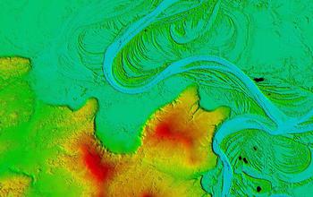
The winding Koyukuk River in Western Alaska is a 425-mile-long tributary of the Yukon River. The digital elevation models show the unique boreal forest vegetation patterns that surround the river region in greater detail than ever before, bringing the unique Arctic landscape into focus.
Credit: NSF / NGA
Download the high-resolution JPG version of the image. (2.5 MB)
Use your mouse to right-click (Mac users may need to Ctrl-click) the link above and choose the option that will save the file or target to your computer.
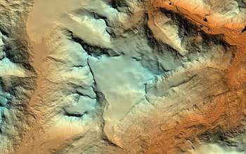
Wolverine Glacier is a valley glacier in the coastal mountains of south-central Alaska's Kenai Peninsula.
Credit: NSF / NGA
Download the high-resolution JPG version of the image. (1.4 MB)
Use your mouse to right-click (Mac users may need to Ctrl-click) the link above and choose the option that will save the file or target to your computer.