All Images
News Release 08-213
New Earth System Science Results Reported at Conference
NSF-funded research presented at American Geophysical Union fall meeting, Dec. 15-19
This material is available primarily for archival purposes. Telephone numbers or other contact information may be out of date; please see current contact information at media contacts.

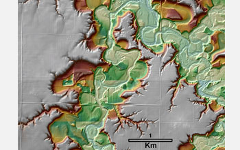
The Le Sueur River watershed in southern Minnesota is the site of "sediment fingerprinting" to trace the origin of sand and gravel.
Credit: National Center for Earth-surface Dynamics
Download the high-resolution JPG version of the image. (426 KB)
Use your mouse to right-click (Mac users may need to Ctrl-click) the link above and choose the option that will save the file or target to your computer.

A high-resolution camera takes pictures daily of Gothic Pool on the South Fork of the Eel River in California. Scientists are studying the timing and extent of algae growth in the pool, and how that affects water flow, linking ecology and geomorphology.
Credit: National Center for Earth-surface Dynamics
Download the high-resolution JPG version of the image. (244 KB)
Use your mouse to right-click (Mac users may need to Ctrl-click) the link above and choose the option that will save the file or target to your computer.

Scientists have found two holes in Earth's magnetic field that allow in solar particles.
Credit: NASA
Download the high-resolution JPG version of the image. (218 KB)
Use your mouse to right-click (Mac users may need to Ctrl-click) the link above and choose the option that will save the file or target to your computer.

The Jurassic Tank at NSF's National Center for Earth-surface Dynamics uses an electronic system to show how sediments are deposited over long time scales.
Credit: National Center for Earth-surface Dynamics
Download the high-resolution JPG version of the image. (242 KB)
Use your mouse to right-click (Mac users may need to Ctrl-click) the link above and choose the option that will save the file or target to your computer.

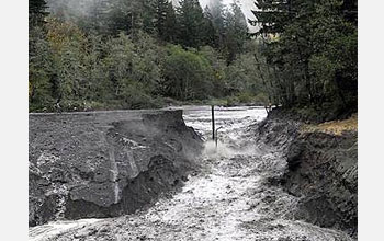
This time-lapse image shows the rapid flow of Oregon's Sandy River after removal of the Marmot Dam.
Credit: U.S. Geological Survey
Download the high-resolution JPG version of the image. (35 KB)
Use your mouse to right-click (Mac users may need to Ctrl-click) the link above and choose the option that will save the file or target to your computer.

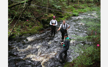
The condition of channels in rivers may affect salmon habitat and spawning success.
Credit: Noah Snyder, Boston College
Download the high-resolution JPG version of the image. (2.3 MB)
Use your mouse to right-click (Mac users may need to Ctrl-click) the link above and choose the option that will save the file or target to your computer.
