
Multimedia Gallery

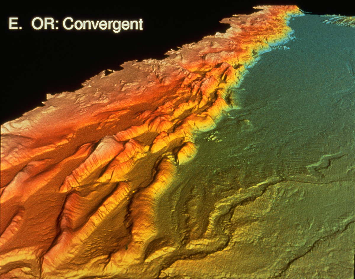
Computer-generated image of Oregon's seascape
A computer-generated image of Oregon's seascape.
More About this Image:
Off the coast of Oregon, two of the Earth's crustal plates come together. The North American Plate rides roughshod over the Juan de Fuca Plate, pushing it down into the Earth's interior and, in the process, scraping up seafloor sediments and leaving them in piles similar to the folds in a carpet.
This computer-generated image of Oregon's seascape is one of several views of the continental margins that Lincoln Pratson, a geologist at the University of Colorado and the National Oceanic and Atmospheric Administration (NOAA), and his colleague William Haxby studied while they both were at the Lamont-Doherty Earth Observatory. Other sites include the Florida and Louisiana coasts.
The collection of data used in creating these pictures began in 1983, when president Ronald Reagan declared that the nation's boundaries extend 230 miles off any U.S. shore. The U.S. Geological Survey performed the general mapping while NOAA and scientists--supported by the National Science Foundation--used multi-beam, echo-sounding systems to get high-resolution images.
Using several datasets, Pratson and Haxby evaluated the continental margins at five survey sites. The images show the naked forces of geology. Tectonics, sedimentation and lithology (the study of structure and composition of rocks) have all been stripped of trees, grasses and other appendages of land, revealing their raw power and unexpected variety. For example, a site off the western coast of Florida contrasts sharply with its nearby state. Instead of Florida's uniform, gentle slopes, the continental margin has sharp edges and mile-high cliffs that drop to the abyss below.
Aside from the accompanying analysis providing new tools in the study of ocean floors, Pratson expects the images will assist companies that are considering gas or oil exploration and those laying transcontinental cables.
Credit: Image by Pratson and Haxby, Lamont-Doherty Earth Observatory
Images and other media in the National Science Foundation Multimedia Gallery are available for use in print and electronic material by NSF employees, members of the media, university staff, teachers and the general public. All media in the gallery are intended for personal, educational and nonprofit/non-commercial use only.
Images credited to the National Science Foundation, a federal agency, are in the public domain. The images were created by employees of the United States Government as part of their official duties or prepared by contractors as "works for hire" for NSF. You may freely use NSF-credited images and, at your discretion, credit NSF with a "Courtesy: National Science Foundation" notation.
Additional information about general usage can be found in Conditions.
Also Available:
Download the high-resolution JPG version of the image. (1 MB)
Use your mouse to right-click (Mac users may need to Ctrl-click) the link above and choose the option that will save the file or target to your computer.