
Multimedia Gallery

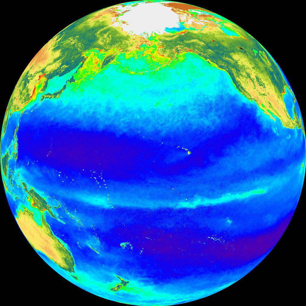
In this map of the Pacific Ocean, the deep blue areas are the nutrient-poor and low-fertility ce ...
In this map of the Pacific Ocean, the deep blue areas are the nutrient-poor and low-fertility central gyres of the major ocean basins. Fewer phytoplankton grow here. The lighter blue areas represent more productive regions with higher rates of nutrient input and consequently higher phytoplankton biomass. The continental shelves and upwelling regions (e.g., along the equator) tend to have higher biomass because of nutrient input.
Credit: Map Courtesy of the National Oceanic and Atmospheric Administration
Images credited to the National Science Foundation, a federal agency, are in the public domain. The images were created by employees of the United States Government as part of their official duties or prepared by contractors as "works for hire" for NSF. You may freely use NSF-credited images and, at your discretion, credit NSF with a "Courtesy: National Science Foundation" notation.
Additional information about general usage can be found in Conditions.
Also Available:
Download the high-resolution JPG version of the image. (257 KB)
Use your mouse to right-click (Mac users may need to Ctrl-click) the link above and choose the option that will save the file or target to your computer.
Related story: The Power Of One: Unicellular Organisms Contribute More Nitrogen To Ocean Than Reported Earlier, Affect Global Atmosphere