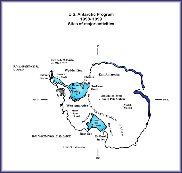
ContentsU.S. Antarctic Program, 1998-1999
|
eology and geophysics Air-ground study of tectonics at the boundary between the eastern Ross embayment and western Marie Byrd Land, Antarctica: Basement geology and structure. Christine S. Siddoway, Colorado College. Our project combines air and ground geological–geophysical investigations to understand the tectonic and geological development of the boundary between the Ross Sea Rift and the Marie Byrd Land volcanic province. Our objective is to determine the Cenozoic tectonic history of the region and to learn whether Neogene structures that localized outlet glacier flow developed within the context of Cenozoic rifting on the eastern Ross embayment margin or within the volcanic province in Marie Byrd Land. The geological structure at the boundary between the Ross embayment and western Marie Byrd Land may be a result of
Faulting and volcanism, mountain uplift, and glacier downcutting appear to be active now in western Marie Byrd Land, where generally east-to-west-flowing outlet glaciers incise Paleozoic and Mesozoic bedrock, and deglaciated summits indicate a previous north-south glacial flow direction. Our study requires data collection using SOAR, or Support Office for Aerogeophysical Research, a facility that uses high-precision differential global positioning system technology to support a laser altimeter, ice-penetrating radar, a towed proton magnetometer, and a Bell BGM-3 gravimeter. Data will be acquired over several key features in the region including, among others,
SOAR products will include glaciology data useful for studying driving stresses, glacial flow, and mass balance in the west antarctic ice sheet. During our ground program, centered on the southern Ford Ranges, we will map small-scale brittle structures for regional kinematic interpretation, glaciated surfaces and deposits, and datable volcanic rocks for geochronologic control. We will also determine the relative significance of fault and joint sets, the timing relationships between them, and the probable context of their formation along with exposure ages for erosion surfaces and moraines. To aid in the interpretation of potential field data, we will sample magnetic properties and density as well as take ground-based gravity measurements and oriented samples for paleomagnetic studies. By combining airborne and ground investigations, we will obtain basic data for describing the geology and structure at the eastern boundary of the Ross embayment both in outcrop and ice covered areas. These data may also help and may be used to distinguish between Ross Sea rift-related structural activity from uplift and faulting on the perimeter of the Marie Byrd Land dome and volcanic province. Outcrop geology and structure will be extrapolated with the aerogeophysical data to infer the geology that resides beneath the west antarctic ice sheet. The new knowledge of Neogene tectonics in western Marie Byrd Land will contribute to a comprehensive model for the Cenozoic Ross rift and to understanding of the extent of plume activity in Marie Byrd Land. Both are important for determining the influence of Neogene tectonics on the ice streams and the west antarctic ice sheet. (GF-088-O) Global positioning system measurement of isostatic rebound and tectonic deformation in Marie Byrd Land, West Antarctica. Bruce Luyendyk, University of California at Santa Barbara. The Ross embayment and western Marie Byrd Land are part of the west antarctic rift system. Most scientists agree that this region is undergoing active deformation, but the rates and causes of deformation remain essentially unknown. Tectonic extension may be occurring in the Ross embayment as West and East Antarctica separate today. Crustal uplift could be occurring in western Marie Byrd Land due to isostatic rebound following the last glacial age. Tectonic extension, if it is occurring in the embayment, could greatly influence global plate circuit calculations, depending on its magnitude. The tectonic extension rate also can constrain our understanding of the history of extension in the embayment and the uplift history of the Transantarctic Mountains. Postglacial rebound in western Marie Byrd Land would depend on the configuration of the ice sheet during the Last Glacial Maximum and when this occurred. The main question is whether the ice sheet collapsed in mid-Holocene time. Our plan is to install three continuous and autonomous global positioning system (GPS) stations on outcrops in western Marie Byrd Land on baselines of around 100 kilometers. These stations, which will gather data over a 4-year period, will operate in concert with GPS stations being installed in the Transantarctic Mountains in a separate project, resulting in a long baseline array across the Ross embayment. We will download data twice each season to acquire up to 6 months of coverage. If a cost-effective satellite communications system is in operation at the time of our survey, we will use that. We expect to determine crustal strain rates to an accuracy of 1 millimeter per year horizontal and 2 millimeters per year vertical. The array will also detect strain gradients in western Marie Byrd Land. The strain data from western Marie Byrd Land and the Transantarctic Mountains will enable us to construct models for tectonic extension and glacial rebound. This is a joint project between Bruce Luyendyk of the University of California at Santa Barbara and Andrea Donnellan, Carol Raymond, and Erik Ivins of the Jet Propulsion Laboratory at the California Institute of Technology. Our team brings together experts in western Marie Byrd Land geology and tectonics, tectonic geodesy, and lithospheric deformation. (GF-121-O) Cretaceous-Paleogene foraminifera of the Victoria Land Basin (Cape Roberts Project). Peter-Noel Webb, Ohio State University. We will characterize the foraminifera in drill core recovered by the Cape Roberts Project (CRP) in the southwest Ross Sea. Geophysical site surveys suggest that the drill holes will provide an aggregate thickness of about 1,500 meters of core and span about 30 to about 100 million years (Cretaceous-Paleocene). This interval of geological time is not yet documented by in situ stratigraphic sections in either the Ross Sea or East Antarctica. The nearest comprehensive data sources for the Cretaceous and Paleocene occur in New Zealand, the northern Antarctic Peninsula, and the Southern Ocean. Benthic and planktic foraminifera from the core will be used, together with data from other fossil groups, to provide on-site age and stratigraphic control as drilling progresses. Age correlations will be made with Deep-Sea Drilling Project/Ocean Drilling Project (DSDP/ODP) biostratigraphy from Southern Ocean drill sites and also with New Zealand planktic and benthic zonal/stage schemes. Our principal task is to provide a comprehensive accounting of foraminiferal material present to assist planning of postdrilling investigations. Basic information to be recorded on the foraminifera will include presence, abundance, preservation, species dominance and diversity, stratigraphic distribution, levels of endemism or cosmopolitanism in faunas, and completeness or fragmentation of population structures. The data we record will be used to address a variety of geological problems. Disconformities and acoustic reflectors, which extend across the rift system basins and are also expected to be encountered in the drill hole, will be dated. Major basin subsidence/uplift trends resulting from compaction and/or rift margin faulting will be deduced from benthic foraminiferal bathymetric indicators. More subtle cyclicity in the stratigraphic distribution of benthic species will be used to recognize and document phases of transgression and regression, which, in turn, may indicate a relationship between sea level oscillation and terrestrial glacial events. The final disintegration of Gondwanaland occurred during the Cretaceous–Paleocene; specifically, New Zealand and Australia moved north, away from Antarctica. Foraminifera from the CRP drill holes will contribute to an understanding of the paleogeography and paleoceanography between the highlands and Pacific margin of East Antarctica (the location of the proto-Transantarctic Mountains), and the west antarctic rift system basins between this suspected island chain and the highlands of West Antarctica. This will help scientists know whether the marine margin of East Antarctica, near the drill holes, was located in a Cretaceous cul-de-sac, or whether it occupied, at times, a position on a major oceanic circulation pathway between the southwest Indian Ocean, southwest Pacific, and southwest Atlantic Oceans. (GL-049-A and GL-049-B) Diatom biostratigraphy and paleoenvironmental history of Cape Roberts Project cores. David Harwood, University of Nebraska at Lincoln. We will characterize the diatom fossils in drill core recovered by the Cape Roberts Project (CRP), a major program in the international antarctic earth science community designed to sample antarctic continental margin strata of late Cretaceous through Paleogene age (30 million to 100 million years ago). Drilling operations will include continuous coring from a sea-ice platform on the flank of the Victoria Land basin in the western Ross Sea. Our particular project involves initial field-based paleontologic analysis of siliceous microfossils in Cape Roberts cores. Core sections will be ferried to the Crary Science and Engineering Center (CSEC) for immediate analysis. Diatoms and other siliceous microfossils will provide rapid age-and-paleoenvironmental information during drilling operations. Each season will include preparation of a preliminary biostratigraphic/paleoenvironmental report based on siliceous microfossils. This report will become part of the CRP Initial Reports volume, which will include the preliminary results from other microfossil groups, lithostratigraphic, magnetostratigraphic, and other analyses. Analysis of diatoms and other siliceous microfossils in CRP cores will greatly aid in the development of an integrated biostratigraphy for this poorly known interval in the southern high latitudes. Diatoms will provide evidence of, for example, environmental changes in water depth, primary productivity, and the presence or absence of sea ice. CRP cores will provide an excellent opportunity to study adaptation of diatoms to strong polar seasonality and diatom evolution. By integrating CRP studies with ongoing studies of Paleogene siliceous microfossils in Arctic strata (for example, Ocean Drilling Program Leg 151), the CRP cores will also offer the possibility of gaining a bipolar perspective on Paleogene high-latitude phytoplankton evolution. (GL-051-O) Downhole logging for the Cape Roberts Project. Richard Jarrard, University of Utah. We will do continuous-core and downhole logging at the Cape Roberts Project (CRP) scientific drill holes. The goal of CRP is to study the Early Tertiary and Cretaceous record of climate, tectonics, and sea-level change and to determine the time of onset of antarctic glaciation. Geophysical well logs will be converted into continuous records of variation, and these records can be interpreted as indicating variations in mineralogy and porosity. The detailed one-dimensional records at each hole will be integrated with available high-resolution seismic data to produce a two-dimensional interpretation of the stratigraphy. This geophysical logging program is an essential component of basic characterization of the drill site and is a fundamental part of the effort to produce a stratigraphic framework for interpretation of other scientific work on the core. (GL-055-O) Calcareous nanofossil biostratigraphy and paleoenvironmental history of the Cape Roberts Project cores. James J. Pospichal and Sherwood W. Wise, Florida State University. We will characterize calcareous nanofossils as part of the development of the biostratigraphic framework for drill core recovered by the Cape Roberts Project (CRP). CRP is a major program in the international antarctic earth science community, designed to sample the stratigraphic record that spans the time interval from 30 to 100 million years ago, by drilling four sites on the flank of the Victoria Land basin. We will support the drilling program by providing rapid age-and-paleoenvironmental information through the study of calcareous nanofossils. Working at the Crary Science and Engineering Center (CSEC) at McMurdo Station, Antarctica, we will systematically sample the recovered sedimentary cores and analyze their calcareous nanofossil content. The preparation of an initial reports volume at the end of each of the two drilling seasons will include the results of our work as part of the initial characterization of the cores. The calcareous nanofossil biostratigraphic record spans the entire interval to be cored by the CRP. Recent work on calcareous nanofossils from ocean drilling sites around Antarctica has yielded a refined zonation for the Paleogene and Upper Cretaceous of the Southern Ocean that will provide a high-resolution biostratigraphic framework for hemipelagic and pelagic sediments recovered by Cape Roberts drilling. This research, when combined with data from other fossil groups, magnetostratigraphic data, and other age-dating methods, will provide integrated age control that is essential for other geological investigations. In addition, calcareous nanofossils are excellent paleoenvironmental indicators for surface-water temperature and productivity. Statistical analysis of quantitative population census data will be used to infer paleoenvironmental variations during the Paleogene and Cretaceous. These data, in combination with data from other fossil groups and sedimentological studies, will be useful for assessing climatic change through the critical period of 30–100 million years before the present. (GL-057-O) Initial characterization of organic matter in Cretaceous–Paleogene sedimentary rocks, Cape Roberts, Antarctica. Richard M. Kettler, University of Nebraska at Lincoln. We will characterize the organic geochemical nature of Cretaceous–Paleogene sedimentary rocks from drill core recovered during the Cape Roberts Project (CRP). The core will be described, curated, and sampled for scientific research. The CRP has the potential to answer significant questions regarding the history of the west antarctic rift system, the development of continental ice sheets in Antarctica during the Cretaceous and Paleogene, and the response of biota to climatic deterioration and the development of seaways. Organic geochemical measurements are relevant to these issues and so are included in the initial core characterization studies. We will measure whole-rock carbonate carbon, total carbon, total nitrogen, and total sulfur, analyze the elemental composition of kerogen in selected samples, and perform gas chromatographic analysis of the solvent-soluble organic matter in selected samples. These data will be collected in the Crary Science and Engineering Center (CSEC) at McMurdo Station and will be reported as part of the initial core characterization study of the CRP. (GL-064-O) Beryllium in granulite-facies pegmetites in Archean Napier Complex, Antarctica. Edward S. Grew, University of Maine. I will accompany the Japanese Antarctic Research Expedition (JARE) to study beryllium-enriched minerals in Enderby Land. Beryllium is a rare element in crustal rocks, and enrichments are especially unusual in granulite-facies (high temperature and pressure and relatively dry conditions) metamorphic rocks. I will study unique beryllium-enriched pegmatites in the Archean ultrahigh temperature (up to 1,000° C) granulite-facies Napier Complex in eastern Casey Bay, Enderby Land, East Antarctica. My primary objective is to test the hypothesis that the beryllium originated in the metasediments hosting the pegmatites rather than being a component of a pegmatitic magma. My fieldwork will be conducted during the 1998–1999 austral field season in Enderby Land as a part of the Japanese Antarctic Research Expedition's project entitled "Structure and Evolution of East Antarctic Lithosphere." I will use mineral and rock compositions to determine the evolution and conditions of crystallization of the pegmatites and their host rocks. The results of the project will provide some important insights into geochemical behavior of beryllium under the high-temperatures and low-water regime characteristic of the granulite facies. (GL-067-O) Initial sedimentological characterization of the Late Cretaceous-Early Cenozoic drill cores from Cape Roberts, Antarctica. Ross Powell, Northern Illinois University, and Lawrence Krissek, Ohio State University. An international initiative to collect 1,500 meters of drill core from offshore of Cape Roberts, McMurdo Sound, Antarctica, is intended to provide a better understanding of antarctic history through the late Cretaceous and early Cenozoic. Events during this period, which extends from before the final breakup of Gondwanaland through the onset of antarctic glaciation, are ill-defined by existing data. The Cape Roberts Project (CRP) aims to provide new data about the development of the west antarctic rift system, the subsidence history of the Ross Sea, and ice-sheet fluctuations on Antarctica through this critical time interval. CRP is partly an extension of previous drilling efforts on the antarctic continental margin and is partly a new initiative to document more completely the developmental history of the Ross Sea sector of the Antarctic and southern Pacific region through the late Cretaceous-early Cenozoic. It will draw on the successes of previous drilling efforts to document regional and environmental development with good spatial and temporal resolution, and it will also draw upon newly compiled geophysical databases. CRP is a collaborative endeavor and is currently being supported by six participating countries. Tasks involved in our segment of the project will include initial description and characterization of the stratigraphic successions; these results will be used as the fundamental database for other analyses. The stratigraphic sections will also be used as reference sections for modeling observed marine and geophysical events. Initial sedimentological characterization of the successions will allow the definition of facies, the construction of facies sequences, and the interpretation of depositional environments through time. The end result of the proposed work will be an Ocean Drilling Program-style initial report for each drilling season. These reports will include the stratigraphic log, initial facies and depositional system interpretations, sedimentary petrologic and petrogenetic analyses, and initial clay mineralogical analysis. Information provided by other specialists will also be included in the reports, including biostratigraphy, magnetostratigraphy, geophysical logs, and geochemical interpretations. The initial interpretations of regional history will be presented in these reports, and the regional and global ramifications of this history will be highlighted. (GL-070-O) Paleomagnetic and mineral magnetic characterization of drill cores from the Cape Roberts Project. Kenneth Verosub, University of California at Davis, and Gary Wilson, Ohio State University. The goals of the Cape Roberts Project (CRP) are to elucidate the history of fragmentation of the Pacific margin of Gondwanaland and the history of antarctic glaciation from Cretaceous through Oligocene time. The CRP will operate with an integrated science plan in which all of the initial scientific characterization of the cores will be done at McMurdo Station. The scientific activities associated with characterization of the cores will include magnetostratigraphy, biostratigraphy, petrography, mineralogy, and sedimentology. Age determination is of principal importance in such a project because a temporal framework is necessary to obtain a history of climatic and tectonic events. Our research will determine high-quality paleomagnetic stratigraphy, with the appropriate mineral magnetic studies, in support of the CRP. For the on-site magnetic studies, we will
Detailed environmental and mineral magnetic studies will also enable evaluation of the sediments as recorders of the geomagnetic field. The Cape Roberts records provide the potential to obtain rare high southern latitude constraints on geomagnetic field behavior. Paleomagnetic studies should also provide important data concerning crustal movements and rift development in the Ross Sea sector. (GL-075-O) Stress field history, Cape Roberts, Antarctica. Terry Wilson, Ohio State University. As part of a collaborative research program, we will obtain the first age-calibrated stress-field history within the west antarctic rift system of Antarctica. The opportunity to acquire the stress data is provided by the international drilling program planned at Cape Roberts, which is located along the margin between the uplifted Transantarctic Mountains and the rifted crust of the Victoria Land basin. Information on the paleostress history of the Mesozoic and Cenozoic rift-basin fill will be obtained from the core and downhole logging of natural fractures and faults. To establish the contemporary stress state, we will examine the cores for coring-induced stress fractures, and we will examine the borehole via downhole televiewer and dipmeter for any wellbore breakouts and fractures reactivated by the contemporary stress field. The stress data will be analyzed to address questions relevant to the paleo- and neotectonic evolution of the antarctic plate. The results will contribute to the resolution of outstanding questions such as the cause of the anomalous aseismicity of the continent, the geometry of stresses along the lithospheric boundary between the Transantarctic Mountains and the west antarctic rift system, and the evolution of the antarctic intraplate stress field and its relation to rifting episodes associated with Gondwanaland breakup. Contemporary stress data obtained from this research will be added to the global stress database and will help to fill the current void in the global stress coverage marked by the Antarctic Plate. (GL-079-O) Initial palynological characterization of Cape Roberts drill cores. Rosemary Askin, Ohio State University, and John Wrenn, Louisiana State University. We will characterize palynomorph assemblages recovered from cores from the Cape Roberts Project (CRP). The CRP is designed to core submarine deposits in the western Ross Sea that range in age from middle Late Cretaceous through Miocene. Objectives include
Palynomorphs have proven to be invaluable tools for biostratigraphic and paleoenvironmental interpretation of younger Ross Sea sequences drilled in the Ross Sea embayment. They include both marine (dinocysts) and nonmarine (spores, pollen) types, record extensive and diverse geologic information, and are preserved in a wide variety of lithofacies formed in various paleoenvironments. This project will provide initial palynological characterization of the CRP drill cores in collaboration with New Zealand palynologists. Analyses will focus on providing palynological input for an integrated biostratigraphic and paleoenvironmental framework based on all microfossil groups present. This framework is of fundamental importance to all future geologic, geophysical, and paleontologic studies conducted on the cores and in the drilling area. (GL-080-O) Structure and sedimentology of the Beardmore Group, Antarctica: Latest Neoproterozoic to Early Paleozoic tectonic evolution of the east antarctic margin. John W. Goodge, Southern Methodist University. The Neoproterozoic to early Paleozoic transition (700–500 million years ago) was a critical period in Earth history. During this period, one supercontinent known as Rodinia was coalesced, then fragmented, prior to amalgamation of a second supercontinent referred to as Gondwanaland. During these events, major mountain building, continental erosion, species diversification, sea-level fluctuations, and changes in seawater composition took place. Continental margin sedimentary sequences from this era provide detailed records of sea-level fluctuations, faunal distributions, and postdepositional tectonism. One of these sequences, the Beardmore Group in Antarctica, represents a significant element in the evolution of the east antarctic craton, yet very little is known about its depositional or tectonic history. Previous workers have suggested that the entire Beardmore Group is Neoproterozoic in age and that it records two distinct deformations, the well-known Ross orogeny and an earlier cryptic "Beardmore" orogeny. Reconnaissance field and geochronologic studies indicate that portions of the Beardmore Group are significantly younger than previously thought, and that it shows evidence for Ross deformation only. These preliminary data reflect uncertainty in the geologic relations of these rocks, and they indicate that the Neoproterozoic tectonic history for the region must be revised. To improve understanding of its depositional history and its role in orogenic events shaping the outer margin of Gondwanaland, we will investigate the Beardmore Group. The project will include
During the 1998–1999 and 1999–2000 austral summers, we will test a recently proposed model for Beardmore Group deposition and deformation that involves latest Neoproterozoic–early Paleozoic(?) rift-margin sedimentation and structural inversion as an early expression of Ross activity. The results will help to resolve directly long-standing uncertainties in the geologic history of the Antarctic, and they will improve our understanding of global paleogeographic and plate-tectonic relations during supercontinent transformation at the close of the Proterozoic. (GO-014-O) Antarctic surveying and mapping program. Richard E. Witmer and Jerry L. Mullins, U.S. Geological Survey. Production and publication of maps of Antarctica serve four U.S. policy objectives.
Surveying and mapping comprise a variety of activities necessary for the successful operation of a multifaceted scientific and exploration effort in Antarctica. Year-round data acquisition, cataloging, and data dissemination will continue in the Scientific Committee for Antarctic Research (SCAR) Library for Geodesy and Geographic Information. Field surveys are planned as part of a continuing program to collect data suitable for future satellite mapping programs and to densify extant data for 1:50,000-scale mapping programs. These maps will provide a base to portray scientific information, such as geologic data, in an especially accurate manner for expert analysis. They will also support future expeditions with a base to design scientific investigations and data-collection activities. The U.S. Geological Survey has been selected to perform the nation's antarctic mapping because it is the designated agency for mapping of the United States and because it possesses the necessary expertise, antarctic experience (developed since 1959), and institutional continuity. A 1991 Memorandum of Agreement between the U.S. Geological Survey and the National Science Foundation established the purpose and tasking for the antarctic mapping. (GO-052-O) Stability of land surfaces in the dry valleys: Insights based on the dynamics of subsurface ice and sand-wedge polygons. Bernard Hallet, University of Washington. We will study features of the landscape and soils of the dry valley region of Antarctica to provide a more complete understanding of past climatic and environmental conditions. The dynamic nature of climate has received growing public attention because of the occurrence of seemingly extreme weather events recently, and growing concerns about warming. El Niño and global greenhouse warming have become familiar topics in the news. In this context, understanding the inherent variability of Earth's climate and how humans can affect Earth's environment is becoming increasingly more important. One important means of improving our understanding of the Earth's climate system is to treat the Earth as a natural laboratory and examine its past behavior. One of the most extreme changes in the Earth's climate system during the last few million years has been the transition from a warm period in the Pliocene to an ice-age world. Scientists believe that during this interval in Antarctica, relatively mild conditions gave way rapidly to intense glacial conditions that catalyzed the growth of the largest ice sheet on Earth. This inference is based on geologic indicators of past climate from which some scientists suggest that East Antarctica was relatively warm and largely free of glaciers about 3–4 million years ago (during parts of the Pliocene). The mild conditions ended abruptly by rapid ice-sheet growth and development of the very cold, dry climate that now characterizes this region. A contrasting view, based on substantial geologic evidence, suggests that East Antarctica has been cold and the ice sheet stable for at least 8 million years, and perhaps considerably longer. These views lead to drastically different interpretations of the stability of Earth's climate. We hope this project will contribute to resolving this important dilemma by introducing independent new evidence and insights derived from studies of the stability of ground ice and land surfaces in the dry valleys of Antarctica. We will study modern-day processes that have important implications for understanding the occurrence of buried ice found recently in Beacon Valley. This ice may be the oldest ice on Earth and, if so, will provide strong evidence of long-term stability of the east antarctic ice sheet and may provide a rare glimpse at atmospheric conditions millions of years ago. Specific processes to be investigated include
Antarctic search for meteorites. Ralph Harvey, Case Western Reserve University. Since 1976, ANSMET (the Antarctic Search for Meteorites program) has recovered more than 9,000 meteorite specimens from locations along the Transantarctic Mountains. Antarctica is the world's premier meteorite hunting ground for two reasons.
Continued recovery of antarctic meteorites is important because they are the only currently available source of new, nonmicroscopic extraterrestrial material, and they provide essential ground truth about the composition of asteroids, planets, and other bodies of our solar system. During the 1998–1999 field season, ANSMET will travel to the Graves Nunataks icefields near the top of the Scott Glacier, just east of the La Gorce Mountains. The general region is just a little "northeast" of where the Transantarctic Mountains reach their most southerly point. The region was visited by ANSMET for 11 days during the 1995–1996 field season, and although weather conditions reduced our searching to only a few days, the area proved its potential as a meteorite concentration when 33 specimens were recovered. ANSMET's objective for the 1998–1999 season is to return to these icefields and conduct systematic searching there, as well as reconnoiter several other icefields within a short traversing distance. (GO-058-O) Tracking the west antarctic rift flank. Paul Fitzgerald and Suzanne L. Baldwin, University of Arizona. Scientists believe that the uplifted Cenozoic rift shoulder of the west antarctic rift system extends along the Transantarctic Mountains and the northwestern flank of the Ellsworth–Whitmore Mountains crustal block. Available fission track data from the Ellsworth–Whitmore Mountains block indicate that although most of the erosion exposing the rock strata (denudation) occurred there in Late Jurassic–Early Cretaceous, a significant component of denudation is permissible in the Cenozoic. In contrast, most of the rock uplift and denudation in the Transantarctic Mountains occurred in the Cenozoic. The timing of uplift and denudation at key localities, plus the patterns of uplift and denudation along the west antarctic rift shoulder, revealed from the thermochronologic studies we will conduct, will be used to address this hypothesis. Our objectives are
We will address these objectives using thermochronologic techniques: namely, apatite fission track thermochronology and argon-40/argon-39 (40Ar/39Ar) thermochronology. During our first field season, we will be in the Thiel Mountains and travel from there to selected nunataks in the Ellsworth–Whitmore Mountains crustal block: Pagano Nunatak, Stewart Hills, Mount Moore, and Mount Woollard. Our second field season will be in the Horlick Mountains and the Ohio Range. Each field season will be followed by a year for sample preparation, data collection and analysis, and ongoing interpretation and presentation of results. All laboratory work will be undertaken at the Center for Thermochronology and Noble Gas Studies at the University of Arizona. The application of low-temperature thermochronologic methods has made fundamental contributions to our understanding of the uplift and denudation history of the Transantarctic Mountains and the Ellsworth Mountains. It is expected that additional data that integrates both fission track and 40Ar/39Ar thermochronology will lead to a better understanding of the geological evolution and relationship between the west antarctic rift system, its uplifted rift shoulder, and East and West Antarctica. (GO-059-O) Heat and chemical exchange during the early stages of back-arc rifting in a polar region: Hydrothermal activity in Bransfield Strait, Antarctica. Gary Klinkhammer and Martin R. Fisk, Oregon State University. We will investigate hydrothermal venting in Bransfield Strait, between the South Shetland Islands and the Antarctic Peninsula. During earlier explorations in the strait, researchers found several sites where hot hydrothermal fluids emanate from the seafloor. An instrument package designed to detect and map the thermal and chemical signature that hydrothermal activity leaves on the overlying water column enabled scientists to locate the hydrothermal sites, which range in water depth from less than 200 meters to 1,300 meters and occur on the volcanic outcrops that periodically protrude through the sediment cover along the strike of the rift zone. These sites are aligned with the Deception Island caldera, which has active hot springs. Because these sites are the first submarine hydrothermal sites discovered in Antarctica, they represent unique research opportunities. We will return to the strait to continue mapping and sampling these areas. Four compelling reasons lead scientists to believe that further exploration of vent systems in the Bransfield will yield exciting new information.
Maestrichtian Land Mammals of Vega Island, Antarctic. Judd A. Case, St. Mary's University. The Maestrichtian is considered to have been a key interval in the development of the land mammal fauna of southern Gondwanaland from Australia to Antarctica and South America. Until now, no Maestrichtian fossil land mammals have been found in any of these continents. The Lopez de Bertodano Formation of Vega Island, Antarctic Peninsula, shows the best potential of yielding remains of land mammals of Maestrichtian age in any southern Gondwanaland location. This project, a collaborative venture between St. Mary's University, the University of California at Riverside, and Argentine scientists, is designed to take advantage of that opportunity. Current theory predicts that the presently unknown Maestrichtian-age land mammal fauna in Antarctica should consist
The australidelphians should include early members of the (currently) South American Microbiotheriidae as well as early lineages of the (currently) Australian Peramelina, Dasyuromorphia, and Diprotodontia. We will test this hypothesis in terms of the composition of the Maestrichtian land mammal fauna by conducting field research in Vega Island of the James Ross Island basin, Antarctic Peninsula. The location has been chosen on the basis of its known productivity in yielding Maestrichtian-age vertebrates (presbyornithid birds and hypsilophodont dinosaurs) in near-shore fine-grained shallow-water marine sandstones of the Lopez de Bertodano Formation that are amenable to dry or wet sieving collecting methods. Such methods have proven successful in obtaining fossil mammals from similar facies in the medial Eocene La Meseta Formation of Seymour Island. This is a cooperative project with the Antarctic Institute, Argentina, (IAA) and the Museo de La Plata, Argentina (MLP). MLP personnel are collaborating on research into the evolutionary history of Late Cretaceous to early Tertiary therian mammals in South America and Antarctica and the potential relationship of these to the early population of Australia. The collaboration with IAA personnel is focused on litho- and biostratigraphy of the marine successions. The first grant year (1997–1998) focused on examining existing material. Years 2 (1998–1999) and 3 (1999–2000) will focus on fieldwork on Vega Island and follow up examination of any fossil discoveries. (GO-061-O) The SWEAT model and Neoproterozoic–Cambrian orogenies in Antarctica: Tests from the Nimrod Glacier region. Anne Grunow, Ohio State University. The Southwest U.S.–East Antarctica (SWEAT) model, which places the ancient continent Laurentia against East Antarctica and Australia in the Neoproterozoic, continues to be a controversial and exciting subject for researchers. We will test the SWEAT hypothesis by providing tighter age constraints on the purported Rodinia rifting-related sedimentary and volcanic rocks and determining a paleolatitude and paleopole for the central Transantarctic Mountains at this time. Researchers believe that following rifting, these Neoproterozoic rocks were deformed during the poorly understood Beardmore and Ross orogenies. In addition to testing the SWEAT hypothesis, we will also provide further structural and geochronologic data to constrain the timing and kinematics of these deformational events. (GO-062-O) A test for Tertiary-age deep fluvial incision and strongly melting valley-glaciers in the dry valleys using ground-penetrating radar: A pilot project. Michael Prentice, University of New Hampshire. During our project, we will study two types of large morphologic features in the McMurdo Dry Valleys using ground-penetrating radar (GPR), a technique not previously used on antarctic sediments.
In addition, we will use conventional surficial geologic techniques to examine a few distinctive drift patches that crop out asymmetrically on trunk-valley walls. These patches appear to be traceable into high alpine valleys and so may have been deposited from expanded alpine glaciers that merged with trunk-valley glaciers. If we are correct, these patches record the synchronous advance of alpine and trunk-valley glaciers. A synchronous advance implies that the coeval climate was significantly wetter and warmer than in the high-polar state. (GO-063-O) Holocene paleoenvironment change along the Antarctic Peninsula: A test of the bipolar/solar signal. Eugene Domack, Hamilton College. During this multidisciplinary, multi-institutional project, we will work to elucidate the detailed climate history of the Antarctic Peninsula during the Holocene epoch (the last 10,000 years). The Holocene is an important, but often overlooked, portion of the antarctic paleoclimatic record because natural variability in Holocene climate on timescales of decades to millennia can be evaluated as a model for our present "interglacial" world. Our project builds on over 10 years of prior investigation into the depositional processes, productivity patterns, and climate regime of the Antarctic Peninsula. This previous work identified key locations that contain ultra-high-resolution records of past climatic variation. These data indicate that solar cycles operating on multicentury and millennial timescales are important regulators of meltwater production and paleoproductivity. These marine records can be correlated with ice-core records in Greenland and Antarctica. We will study sediment dispersal patterns across the Palmer Deep region. The objective is to understand the present links between the modern climatic and oceanographic systems and sediment distribution. In particular, additional information is needed regarding the influence of sea ice on the distribution of both biogenic and terrigenous sediment distribution. Sediment samples will be collected with a variety of grab sampling and coring devices. Two additional objectives are the deployment of sediment traps in front of the Muller Ice Shelf in Lallemand Fjord and seismic reflection work in conjunction with site augmentation. The goal of sediment-trap work is to address whether sand transport and deposition adjacent to the ice shelf calving line results from meltwater or aeolian processes. In addition, the relationship between sea-ice conditions and primary productivity will be investigated. The collection of a short series of seismic lines across the Palmer Deep basins will fully resolve the question of depth to acoustic basement. (GO-072-A) Dry valleys seismograph project. Bob Reynolds, U.S. Geological Survey. The dry valleys seismograph project was established in cooperation with the New Zealand Antarctic Program to record broadband, high-dynamic-range digital seismic data at a remote site removed from the environmental and anthropogenic noise on Ross Island. The Wright Valley offers one of the few locations on the continent where bedrock can be accessed directly. The station consists of a triaxial broadband borehole seismometer at 100 meters depth and a vertical short-period instrument at 30 meters depth. These data are digitized at the remote location and then are radio-frequency telemetered via repeaters on Mount Newell and Crater Hill, eventually to the recording computer located in the Hatherton Laboratory at Scott Base. Although archived at Scott Base for backup purposes, the data do not stop flowing at this point. The data pass via a point-to-point protocol link to the Internet at McMurdo Station and then on to the Albuquerque Seismological Laboratory for distribution to the seismological community. This data set has beautifully complemented the data from the other seismic stations that the Albuquerque Seismological Laboratory operates on the antarctic continent at Amundsen–Scott South Pole Station, Palmer Station, and the Australian station, Casey. (GO-078-O) Global positioning system measurements of crustal motion in Antarctica. Barclay Kamb, California Institute of Technology. We will establish a global positioning system (GPS) geodetic network in the Transantarctic Mountains of Antarctica to measure vertical and horizontal crustal velocities. The vertical crustal velocities measured by GPS reflect the viscoelastic response of the solid Earth to antarctic deglaciation. Data from this GPS network will be used to test models of late Pleistocene–early Holocene versus late Holocene deglaciation of Antarctica. These data will also constrain the length of time over which the antarctic ice sheet disintegrated and the distribution of the peak glacial load. A mid-Holocene deglaciation model produces a predicted uplift pattern near the Transantarctic Mountains that can be measured by high-precision GPS geodetic measurements within a time span of 4 years. Horizontal deformation induced by rebound will also be measured. These data will also help constrain present-day changes in antarctic ice mass by monitoring the elastic deformation of the lithosphere resulting from ongoing glacial loading and unloading. The lithospheric response to ongoing ice-mass changes is predicted to be an order of magnitude less than the viscoelastic response to late Pleistocene–Holocene deglaciation. Tectonic uplift rates are also predicted to be very small compared to the predicted rebound signal for this region. Baselines across faults in the Transantarctic Mountains may capture coseismic motion, if an earthquake were to occur, or aseismic slip. During the 1998–1999 field season, we will visit existing autonomous GPS station (AGS) sites at Mount Coates and Mount Cox to perform maintenance, upgrades, and repairs. We will also perform geodetic surveys at Mount Coates and Mount Cox to assess site stability and to ensure recovery of the site in case the original pin is damaged or unstable. Finally, we will search for areas that would be suitable for future sites in the AGS network, and we may install a new AGS this season. The AGS network sends daily data reports to McMurdo Station. The network is designed to be a permanent installation that will continue to monitor motion in the region beyond the term of this project. Advanced processing techniques have been employed to increase the accuracy of the crustal velocity measurements, especially for the vertical component. These include orbit modeling, troposphere correction, ionosphere correction, and extraction of annual and seasonal solid Earth and ocean tidal signals. (GO-082-O) Mechanism and timing of west antarctic ice sheet retreat at the end of the last glacial maximum. John B. Anderson, Rice University. We will continue a long-term investigation of the continental shelf sediments to examine the configuration of the west antarctic ice sheet during the last glacial maximum, the events and mechanisms involved in its retreat, and the timing of retreat. Our project involves
Detailed seafloor imagery (multibeam and deep-tow side-scan sonar), high-resolution seismic reflection profiles, and sediment cores will be used to map and characterize prior grounding zones. Of particular concern are features that indicate the amount and organization (channelization) of basal meltwater and the extent of bed deformation that occurred in different ice streams. The timing of ice-sheet retreat provides information about the link between Northern and Southern Hemisphere ice expansion and the role of eustasy in ice-sheet decoupling. Our research should lead to better predictive models to determine which ice streams are most unstable and likely, therefore, to serve as "weak links" in the long-term behavior of west antarctic ice sheet. (GO-083-O) Scotia Arc GPS Project (SCARP). Lawrence A. Lawver, Ian W. Dalziel, and Frederick W. Taylor, University of Texas at Austin. Antarctica, Earth's most isolated continent, is surrounded by actively spreading ridges except in the South American sector. The motion of South America with respect to Antarctica is latitudinal and left-lateral at approximately 22 millimeters per year and is distributed along the boundaries of the intervening Scotia Plate. A prominent but discontinuous bathymetric high, known as the Scotia Ridge surrounds the Scotia Plate on three sides, and includes some continental material detached from the South America and Antarctica, but its eastern closure is a volcanically and seismically active group of islands, the South Sandwich arc, that is separated from the Scotia Plate by a vigorously spreading back-arc ridge. The entire east-closing, locally emergent bathymetric feature joining the two continents is known as the Scotia Arc. The D-shaped Sandwich Plate and arc appear to be moving rapidly east with respect to both South America and Antarctica, thereby for the first time introducing a subduction system into the otherwise rift-bounded South Atlantic Ocean basin. During this Scotia Arc GPS Project (SCARP), we will use the global positioning system (GPS) to measure the plate motions between South America, Antarctica, and Africa, and around the Scotia Arc using multimodal occupation strategy (MOST). We will set up permanent GPS receivers at a small number of sites in South America and Antarctica and use additional receivers to position numerous stations relative to this continuously operating network. Two seasonally occupied stations in the South Sandwich Islands will be tied to permanent GPS sites in South America, Antarctica, and Africa and to intervening stations in the Falkland, South Georgia, and South Orkney Islands that will be occupied occasionally by our British collaborators. During the initial 3 years, the South Sandwich Arc motion will be easily resolved, and using roving stations in the Antarctic Peninsula–South Shetland Islands area, it should be possible to determine if extension is occurring across Bransfield Strait. We will also construct a relatively dense subnetwork in Patagonia/Tierra del Fuego and a moderately dense subnetwork in the Antarctic Peninsula. The objectives of SCARP are to determine
Logistics support for global seismic station at the South Pole. Rhett Butler, Incorporated Research Institution for Seismology. With logistics support from the National Science Foundation, we will install, maintain, and operate IRIS seismic equipment at Amundsen–Scott South Pole Station and at Palmer Station, Antarctica. The Incorporated Research Institution for Seismology (IRIS) is a consortium of research institutions created to implement critically needed national facilities for support of seismological research on the Earth's interior in the coming quarter century. With a membership of 57 universities, IRIS includes nearly all U.S. universities that have seismological research programs. IRIS has developed a 10-year plan for the implementation of a global seismographic network (GSN) of about 100 broadband, digital, wide-dynamic-range stations that transmit data via satellite in a broadcast mode so that any site on Earth can access the complete global data set, if desired, in real time. The installation of a state-of-the-art, broadband, digital seismic observation for the South Pole is part of an effort by the National Science Foundation to improve seismic instrumentation globally. A modern seismic station at South Pole and Palmer will provide a crucial link in the global seismic network and is essential for seismic studies of the antarctic continent. (GO-090-O and GO-091-O) A broadband seismic experiment for study of the tectonics and structure of the Antarctic Peninsula and Scotia Sea. Douglas Wiens and Dapeng Zhao, Washington University. The present-day tectonics and seismological structure of the Antarctic Peninsula and Scotia Plate region are among the most poorly understood of any location in the world. This region offers a unique and complex geodynamic setting, as illustrated by the recent cessation of volcanism along the South Shetland Trench and onset of volcanism and rifting in the Bransfield Strait, the possible presence of diffuse deformation and/or microplates in the Drake Passage region, and fast back-arc spreading behind the South Sandwich arc. We constitute the U.S. component of an international effort to study the seismotectonics and seismic structure of the Antarctic Peninsula and Scotia Sea regions using a large-scale deployment of broadband seismographs that began during the 1996–1997 field season. The project will deploy nine broadband PASSCAL seismographs for 2 years in the Antarctic Peninsula region, southernmost Chile, and South Georgia Island. The following questions will be addressed.
Answering these questions will help to constrain important tectonic questions such as the cause of plate motion changes, what processes initiate back-arc spreading, and the relationship between mantle flow and surface tectonics. (GO-097-O) Study of the structure and tectonics of the South Shetland Trench and Bransfield back-arc using ocean-bottom seismographs. LeRoy M. Dorman, Scripps Institution of Oceanography. The South Shetland Arc/Bransfield Strait region presents an intriguing and unique tectonic setting that exhibits slowing of subduction, cessation of island arc volcanism, as well as the apparent onset of back-arc rifting occurring within the last 4 million years. To investigate the seismicity and tectonics of the region, we will use a 5-month deployment of 14 ocean-bottom seismographs (OBSs) to complement and extend a deployment of six broadband land seismic stations that were successfully installed during early 1997. The OBSs include two instruments that have broadband sensors; all have flowmeters for measuring and sampling hydrothermal fluids. The OBSs will be used to examine many of the characteristics of the Shetland–Bransfield tectonic system, including the following.
Antarctic network of unattended broadband integrated seismometers (ANUBIS). Sridhar Anandakrishnan, Pennsylvania State University. The antarctic crust and mantle composition and geometry are poorly known. The primary method for studying the crust, upper mantle, and the deeper asthenosphere is interpretation of seismic data, either by "active" methods acquired through use of explosives or by "passive" means, using natural sources and interpreting various earthquake phase arrival times and amplitudes. Integrating passive and active seismology can result in efficient use of resources to produce detailed images of the lithosphere. Our project will develop a passive seismic network for the antarctic interior. The Antarctic is a gaping hole in the rapidly improving field of global seismic imaging and tomography. On this huge continent, there are only eight broadband seismic observatories. Further, with the exception of South Pole, all of those stations are along the margins of the continent and none are in West Antarctica. By contrast, there are 200 permanent stations worldwide in the FDSN (Federation of Digital Seismograph Networks) and on the order of 1,000 in national networks not yet integrated into the FDSN. We will develop and deploy 11 long-term broadband seismic stations on the continent itself. Because 98 percent of the continent is ice covered, these stations will be installed at the surface of the ice sheet. The body-wave data thus recorded from regional and teleseismic earthquakes can be analyzed at each station for local crustal thickness, lamination, Poisson's ratio (a measure of crustal composition), crust and mantle anisotropy (a measure of current and former stress regimes), and identification of rift zones and crustal block boundaries. In addition, the data from all the stations (including the existing peripheral ones) can be used for seismic tomographic analysis to detail lateral variations in these properties. Six of the stations will be installed at existing automatic geophysical observatory sites (in East Antarctica), which will provide heat and power for the data loggers. The remaining five stations will be in West Antarctica and will be powered and heated by wind turbines during the austral winter. (GO-180-O) Ferrar Large Igneous Province Study (FLIPS). Philip Kyle, New Mexico Institute of Mining and Technology. This international collaborative research project will involve the New Mexico Institute of Mining and Technology and the British Antarctic Survey (BAS). The objective is to understand the origin, emplacement, and evolution of antarctic Jurassic (180-million-year-old) basaltic rocks, which formed when the Gondwanaland supercontinent started to disintegrate. We will test a new unified model for this 180-million-year-old magmatic activity in which the magmatism is caused by a single mantle superplume and is a major factor in continental rifting. In Antarctica, the Jurassic basaltic rocks are divided into two provinces: Ferrar Large Igneous Province (FLIP) and the Dronning Maud Igneous Province (DMIP). (The official U.S. name for Dronning Maud Land is Queen Maud Land. The foreign term will be used for this project because it is a collaboration with BAS.) The origin of the FLIP is problematical and a plume origin has generally been discounted because of its lateral distribution over 3,000 kilometers along the Transantarctic Mountains and also in southern Australia. The FLIP is characterized by unusual geochemical compositions, which have been attributed to their origin from an enriched mantle source. In the model we are investigating, the FLIP magma would have been significantly contaminated in an upper continental crustal magma chamber (probably the Dufek Intrusion) whereas the DMIP has distinctly mantlelike chemical characteristics but still shows some evidence of modification by crustal material. In this research, we will examine and sample the rocks of the DMIP and rocks of the FLIP in the Theron and Pensacola Mountains and Dronning Maud Land and conduct an integrated study of the age, geochemistry, and structural relationships of the FLIP and DMIP. Radiometric age determinations will examine the age relationship between the FLIP and DMIP. Models for upper crustal contamination of the FLIP magmas will be tested using isotopic studies and geochemical modeling. Other studies, conducted by our BAS collaborators, include a regional aerogeophysical survey to determine the size and shape of the Dufek Intrusion and a detailed survey to search for a feeder dike system from the body. (GO-182-O) UNAVCO's global positioning system receiver. Randolph H. Ware, University Center for Atmospheric Research. UNAVCO, a consortium of 30 U.S. universities, manages a satellite facility at McMurdo Station and provides equipment and logistical assistance to earth scientists making use of the global positioning system (GPS) for research in crustal dynamics, earthquake, volcano, and global change research. Using GPS, vector baselines between receivers separated by 100 kilometers or more are routinely measured with 1 centimeter (or 100 parts per billion) accuracy. UNAVCO is also able to support researchers in investigations of global, regional, and local crustal motions where maximum accuracy (in the millimeter range) of baseline measurement is required. In addition to supporting researchers in the U.S. Antarctic Program, UNAVCO's equipment and expertise also support operations at McMurdo Station and Taylor Valley. GPS measurements can be completed using portable equipment in a few hours or less. The ability to make such measurements has found immediate applications in research on global plate tectonics, earthquake mechanics, volcano monitoring, and regional tectonics. The UNAVCO facility in Boulder, Colorado, offers a complete support program for university-based investigators including
UNAVCO also represents the academic research community and acts as a central clearinghouse for information on the scientific applications of GPS. As a part of its service to investigators, UNAVCO tests GPS equipment and techniques and works to improve GPS surveying accuracy. (GO-295-O) Support Office for Aerogeophysical Research (SOAR). Donald D. Blankenship, University of Texas at Austin. The function of the Support Office for Aerogeophysical Research (SOAR) is to facilitate aerogeophysical research over continental Antarctica to help researchers understand the dynamic behavior of the ice sheet and the nature of the lithosphere beneath the ice sheet. SOAR supports peer-reviewed research requiring high-precision laser altimetry, gravity, magnetics, and navigational data sets. SOAR provides information essential to site selection decisions for a west antarctic ice core as well as critical information for selection of locations of over-snow seismic transects. SOAR represents a unique experiment in research support for the U.S. Antarctic Program. It has the potential to revolutionize the conduct of earth science and glaciology research in Antarctica. (GS-098-O) |