News Release 16-038
California drought patterns becoming more common
Atmospheric patterns linked with drought occurred more frequently in recent decades
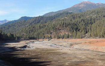
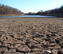
California's Trinity Lake is a mere shadow of its former self, since drought arrived.
April 1, 2016
This material is available primarily for archival purposes. Telephone numbers or other contact information may be out of date; please see current contact information at media contacts.
Find related stories on NSF's geosciences risk and resilience interest area at this link.
Atmospheric scientists have found that California's highest temperatures are almost always associated with blocking ridges, regions of high atmospheric pressure than can disrupt wind patterns -- including one known as the Ridiculously Resilient Ridge. The Triple R, as it's called, is also linked with California's drought.
In new research published online this week in the journal Science Advances, a team of researchers led by Stanford University scientist Noah Diffenbaugh analyzed the occurrence of large-scale atmospheric circulation patterns that occurred during California's historical precipitation and temperature extremes.
"Atmospheric circulation patterns are associated with various weather and climate events, ranging from flash floods caused by single-day downpours to multi-year, continent-wide droughts," Diffenbaugh said.
Diffenbaugh, Stanford researcher Daniel Swain and other co-authors investigated whether atmospheric pressure patterns similar to those that happened during California's historically driest, wettest, warmest and coolest years have occurred more frequently in recent years.
Implications for water resources, agriculture, energy
"Improved understanding of the drought in California has implications for water resources management, agriculture, hydropower and energy," said Anjuli Bamzai, program director in the National Science Foundation (NSF) Division of Atmospheric and Geospace Sciences, which funded the research.
Bamzai said that while the region has recently experienced relief in snowfall and rainfall, "The epic drought is far from over. These scientists show that the frequency of atmospheric circulation patterns that worsen drought conditions has increased over the long-term."
The study focused on the northeastern Pacific Ocean and far western North America, encompassing the winter "storm track" region from which the vast majority of California precipitation originates.
The researchers used historical climate data from U.S. government archives to investigate changes during California's rainy season, from October to May.
They identified the specific North Pacific atmospheric patterns associated with the most extreme temperature and precipitation seasons between 1949 and 2015. The analysis revealed a significant increase in the occurrence of atmospheric patterns linked with certain precipitation and temperature extremes over the 67-year period.
In particular, the scientists found increases in atmospheric patterns resembling what has happened during the latter half of California's ongoing multi-year drought.
"California's driest and warmest years are almost always associated with some sort of persistent high pressure region, which can deflect the Pacific storm track away from California," said Swain. "Since California depends on a relatively small number of heavy precipitation events to make up the bulk of its annual total, missing out on even one or two of these can have significant implications for water availability."
The "Ridiculously Resilient Ridge"
The scientists concluded that one such persistent ridge pattern was diverting winter storms northward and preventing them from reaching California during the state's drought.
In 2014, the researchers published findings showing that the increasing occurrence of extremely high atmospheric pressure over this same part of the northeastern Pacific is very likely linked with environmental change. But the group wanted to know whether the particular spatial pattern associated with the Triple R has become more common -- a question not asked in the 2014 study.
The new study provides a more direct answer to this question. "We found that this specific extreme ridge pattern associated with the ongoing California drought has increased in recent decades," Swain said.
Despite the fact that the number of very dry atmospheric patterns in California has increased, the number of very wet atmospheric patterns hasn't declined.
"We're seeing an increase in certain atmospheric patterns that have historically resulted in extremely dry conditions, and yet that's apparently not occurring at the expense of patterns that have been associated with extremely wet patterns," Swain said. "We're not necessarily shifting toward perpetually lower precipitation conditions in California -- even though the risk of drought is increasing."
That might sound contradictory, but it's not, the scientists say.
Imagine looking at a 10-year period and finding that two of the years are wet, two are dry and the rest experienced precipitation close to the long-term average. Now imagine another decade with three very dry years, three very wet years and only four years with near-average precipitation.
"What seems to be happening is that we're having fewer 'average' years, and instead we're seeing more extremes on both sides," Swain said. "This means that California is starting to experience more warm/dry periods, punctuated by wet conditions."
The role of temperature
Another important contributor to drought is temperature. Diffenbaugh previously found that higher temperatures during periods of low precipitation in California doubled the risk of drought.
The researchers also discovered that the long-term warming of California has substantially increased the number of hot years, thereby increasing the risk that low precipitation periods produce drought.
"The current record-breaking drought in California has arisen from both extremely low precipitation and extremely warm temperature," Diffenbaugh said. "We found clear evidence that the extreme atmospheric pattern associated with these unprecedented warm and dry conditions has become more likely in recent decades."
-NSF-
-
The drought that crippled California is by some measures the worst in the state's history.
Credit and Larger Version -
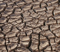
Cracked, dry earth is common throughout California's drying waterways and reservoirs.
Credit and Larger Version -
Drought has drained California's Tuolumne River, leaving riverbed where there was water.
Credit and Larger Version -
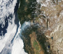
Large, fast-moving wildfires have sparked in Northern and Southern California during the drought.
Credit and Larger Version -
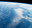
View from the International Space Station in January 2014: No snow on California's mountains.
Credit and Larger Version
Media Contacts
Cheryl Dybas, NSF, (703) 292-7734, email: cdybas@nsf.gov
Ker Than, Stanford University, (650) 723-9820, email: kerthan@stanford.edu
Related Websites
NSF Grant: Dynamics and Impacts of Fine-Scale Climate Change: http://www.nsf.gov/awardsearch/showAward?AWD_ID=0955283&HistoricalAwards=false
NSF News: Cause of California drought linked to climate change: https://www.nsf.gov/news/news_summ.jsp?cntn_id=132709
The U.S. National Science Foundation propels the nation forward by advancing fundamental research in all fields of science and engineering. NSF supports research and people by providing facilities, instruments and funding to support their ingenuity and sustain the U.S. as a global leader in research and innovation. With a fiscal year 2023 budget of $9.5 billion, NSF funds reach all 50 states through grants to nearly 2,000 colleges, universities and institutions. Each year, NSF receives more than 40,000 competitive proposals and makes about 11,000 new awards. Those awards include support for cooperative research with industry, Arctic and Antarctic research and operations, and U.S. participation in international scientific efforts.
Connect with us online
NSF website: nsf.gov
NSF News: nsf.gov/news
For News Media: nsf.gov/news/newsroom
Statistics: nsf.gov/statistics/
Awards database: nsf.gov/awardsearch/
Follow us on social
Twitter: twitter.com/NSF
Facebook: facebook.com/US.NSF
Instagram: instagram.com/nsfgov

