
All Images
News Release 12-199
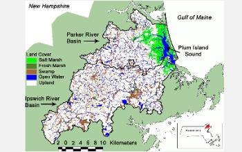
Why Are Coastal Salt Marshes Falling Apart?
Too many nutrients can cause extensive loss of marshes
This material is available primarily for archival purposes. Telephone numbers or other contact information may be out of date; please see current contact information at media contacts.
Where are all the salt marshes going? Excess nutrients may be to blame for their decline.
Credit: NSF Plum Island Ecosystems LTER Site
Download the high-resolution JPG version of the image. (923 KB)
Use your mouse to right-click (Mac users may need to Ctrl-click) the link above and choose the option that will save the file or target to your computer.
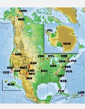
Plum Island Ecosystems, PIE at right on the map, is one of 26 NSF Long-Term Ecological Research sites.
Credit: NSF LTER Network
Download the high-resolution JPG version of the image. (374 KB)
Use your mouse to right-click (Mac users may need to Ctrl-click) the link above and choose the option that will save the file or target to your computer.
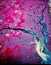
The mouth of the Parker River is a major channel through Plum Island's salt marshes.
Credit: NSF Plum Island Ecosystems LTER Site
Download the high-resolution JPG version of the image. (1 MB)
Use your mouse to right-click (Mac users may need to Ctrl-click) the link above and choose the option that will save the file or target to your computer.
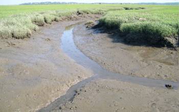
Salt marshes and tidal creeks abound at Plum Island, Mass., and along the Atlantic coast.
Credit: NSF Plum Island Ecosystems LTER Site
Download the high-resolution JPG version of the image. (1 MB)
Use your mouse to right-click (Mac users may need to Ctrl-click) the link above and choose the option that will save the file or target to your computer.
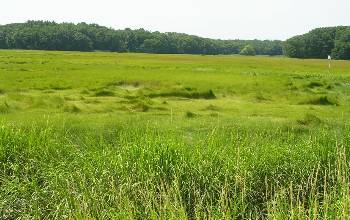
Tidal channels in salt marsh, or Spartina, grass. What is their capacity for carrying nutrients?
Credit: NSF Plum Island Ecosystems LTER Site
Download the high-resolution JPG version of the image. (58 KB)
Use your mouse to right-click (Mac users may need to Ctrl-click) the link above and choose the option that will save the file or target to your computer.
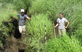
Scientists Erik Yando and Clara Chaisson measure marsh that has slumped into a creek.
Credit: David Johnson
Download the high-resolution JPG version of the image. (4 MB)
Use your mouse to right-click (Mac users may need to Ctrl-click) the link above and choose the option that will save the file or target to your computer.