
All Images
News Release 12-174
How Is Earth's Water System Linked With Land Use, Climate Change and Ecosystems?
Answers may be in new NSF Water Sustainability and Climate research
This material is available primarily for archival purposes. Telephone numbers or other contact information may be out of date; please see current contact information at media contacts.
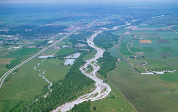
A WSC project will look at Colorado's South Platte River: From mountains to urban lands.
Credit: Jim Wark
Download the high-resolution JPG version of the image. (7.5 MB)
Use your mouse to right-click (Mac users may need to Ctrl-click) the link above and choose the option that will save the file or target to your computer.
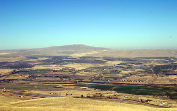
WSC scientists will study the watershed of the Yakima River Basin in Washington State.
Credit: Cailin Orr
Download the high-resolution JPG version of the image. (1.8 MB)
Use your mouse to right-click (Mac users may need to Ctrl-click) the link above and choose the option that will save the file or target to your computer.
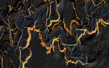
LIDAR image of very steep areas (orange) along the Minnesota River: Hotspots of change.
Credit: National Center for Earth-surface Dynamics/UMN
Download the high-resolution JPG version of the image. (534 KB)
Use your mouse to right-click (Mac users may need to Ctrl-click) the link above and choose the option that will save the file or target to your computer.
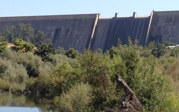
The Lower San Joaquin River in California is fed by water releases from Friant Dam.
Credit: Tom Harmon
Download the high-resolution JPG version of the image. (129 KB)
Use your mouse to right-click (Mac users may need to Ctrl-click) the link above and choose the option that will save the file or target to your computer.
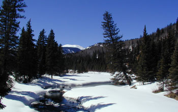
Headwaters of the Rio Grande River in Colorado; snowmelt is the river's main water source.
Credit: Noah Molotch
Download the high-resolution JPG version of the image. (488 KB)
Use your mouse to right-click (Mac users may need to Ctrl-click) the link above and choose the option that will save the file or target to your computer.
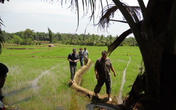
WSC researchers talk about paddy irrigation with a farmer in Sri Lanka.
Credit: George Hornberger
Download the high-resolution JPG version of the image. (5.2 MB)
Use your mouse to right-click (Mac users may need to Ctrl-click) the link above and choose the option that will save the file or target to your computer.