
All Images
Media Advisory 10-032
From Community Mapping to Critical Spatial Thinking
On Nov. 17, as part of NSF's Distinguished Lecture series, world-renowned geographer Michael Goodchild discusses the changing face of GIS
This material is available primarily for archival purposes. Telephone numbers or other contact information may be out of date; please see current contact information at media contacts.
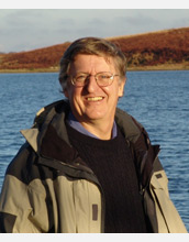
Michael Goodchild discusses "From Community Mapping to Critical Spatial Thinking: The Changing Face of GIS" in a National Science Foundation Distinguished Lecture.
Credit: Chaosheng Zhang, National University of Ireland, Galway
Download the high-resolution JPG version of the image. (117 KB)
Use your mouse to right-click (Mac users may need to Ctrl-click) the link above and choose the option that will save the file or target to your computer.
Director of the University of California, Santa Barbara's Center for Spatial Studies Michael Goodchild discusses "From Community Mapping to Critical Spatial Thinking: The Changing Face of GIS (geographic information systems)" in this National Science Foundation Distinguished Lecture. He discusses how individuals are using distributed, real-time data enabled by social networks to define landscapes that have been suddenly altered by floods, hurricanes and other acts of nature.
Credit: National Science Foundation