
All Images
News Release 10-176
NSF Awards Grant for Continuously Operating Caribbean GPS Natural Hazards Observational Network
COCONet will transform understanding of earthquakes, hurricanes in vulnerable region
This material is available primarily for archival purposes. Telephone numbers or other contact information may be out of date; please see current contact information at media contacts.
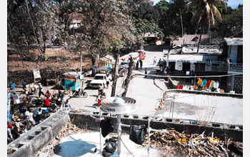
In a pre-earthquake photo, a GPS receiver and antenna sit atop a roof in Port-au-Prince, Haiti.
Credit: Purdue University/Eric Calais
Download the high-resolution JPG version of the image. (340 KB)
Use your mouse to right-click (Mac users may need to Ctrl-click) the link above and choose the option that will save the file or target to your computer.
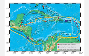
COCONet stations will monitor natural hazards throughout the Caribbean region.
Credit: COCOnet/NSF
Download the high-resolution JPG version of the image. (827 KB)
Use your mouse to right-click (Mac users may need to Ctrl-click) the link above and choose the option that will save the file or target to your computer.
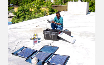
Louis Obenson of Haiti's Civil Protection Agency installs GPS equipment in Port-au-Prince.
Credit: Purdue University/Eric Calais
Download the high-resolution JPG version of the image. (183 KB)
Use your mouse to right-click (Mac users may need to Ctrl-click) the link above and choose the option that will save the file or target to your computer.
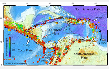
The seismotectonic context of Earth's Caribbean tectonic plate is shown in this map.
Credit: Purdue University/Eric Calais
Download the high-resolution JPG version of the image. (326 KB)
Use your mouse to right-click (Mac users may need to Ctrl-click) the link above and choose the option that will save the file or target to your computer.
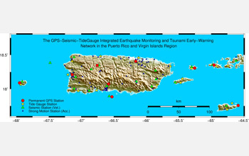
The current GPS-seismic-tide gauge monitoring network in Puerto Rico and the Virgin Islands.
Credit: Puerto Rico Seismic Network
Download the high-resolution JPG version of the image. (1.1 MB)
Use your mouse to right-click (Mac users may need to Ctrl-click) the link above and choose the option that will save the file or target to your computer.