
All Images
News Release 05-132
Rainbands Offer Better Forecasts of Hurricane Intensity
Research project to improve forecasting
This material is available primarily for archival purposes. Telephone numbers or other contact information may be out of date; please see current contact information at media contacts.
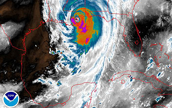
Scientists from the RAINEX project flew into the edge of Hurricane Katrina on Aug. 27 and Aug. 28 to study its rainbands and the formation of its eyewall, taking simultaneous measurements from two aircraft as Katrina grew into Category 5 and bore down on the Gulf Coast. (Click here to track Katrina's progress.)
Credit: NOAA water vapor satellite image
Download the high-resolution JPG version of the image. (110 KB)
Use your mouse to right-click (Mac users may need to Ctrl-click) the link above and choose the option that will save the file or target to your computer.
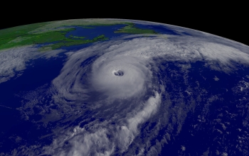
Hurricane Alex in Aug. 2004
Credit: NOAA
Download the high-resolution JPG version of the image. (414 KB)
Use your mouse to right-click (Mac users may need to Ctrl-click) the link above and choose the option that will save the file or target to your computer.
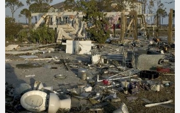
Debris was deposited from the tidal surge of hurricane Ivan in Pensacola, Fla., Sept. 18, 2004.
Credit: Andrea Booher, FEMA